Image
Body
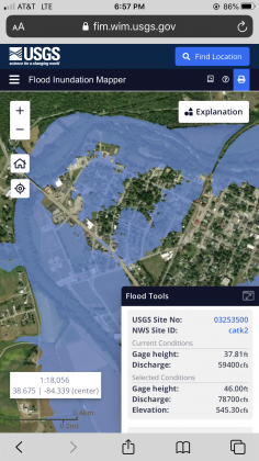
National Weather Service lowered the crest level for the Licking River to 41 feet at 12 a.m. on Thursday, May 21.
The crest level was set in the morning of Tuesday, May 19 at 43 feet. They raised it to 44 feet in the afternoon which would have flooded most of northwest Falmouth.
By 7 p.m. the decrease has significantly shrunk the parts of Falmouth that could expect flooding. Some areas of Falmouth can still expect flooding at the 41 feet crest level.
Many who had lived through the 1997 Flood or heard the stories spent portions of the day moving possessions from their home and businesses.


