

Residents evacuated as waters flood Butler, Falmouth


By Burton Cole
This weekend’s flooding that swamped much of Pendleton County was the worst since the great flood of 1997 put about 80 percent of Falmouth under as much as 10 feet of water.
This time around, “it was much less than everybody thought but still significant,” Rob Braun, Pendleton County Emergency Management spokesman, said. “A whole lot of people got lucky.”
Mandatory evacuation orders for Falmouth were lifted at noon Monday, and for Butler, at 4 p.m. Monday. Portions of many low-lying roads and streets in the county still were impassable because of high waters, but floodwaters were receding.
No injuries or casualties were reported from the flooding.
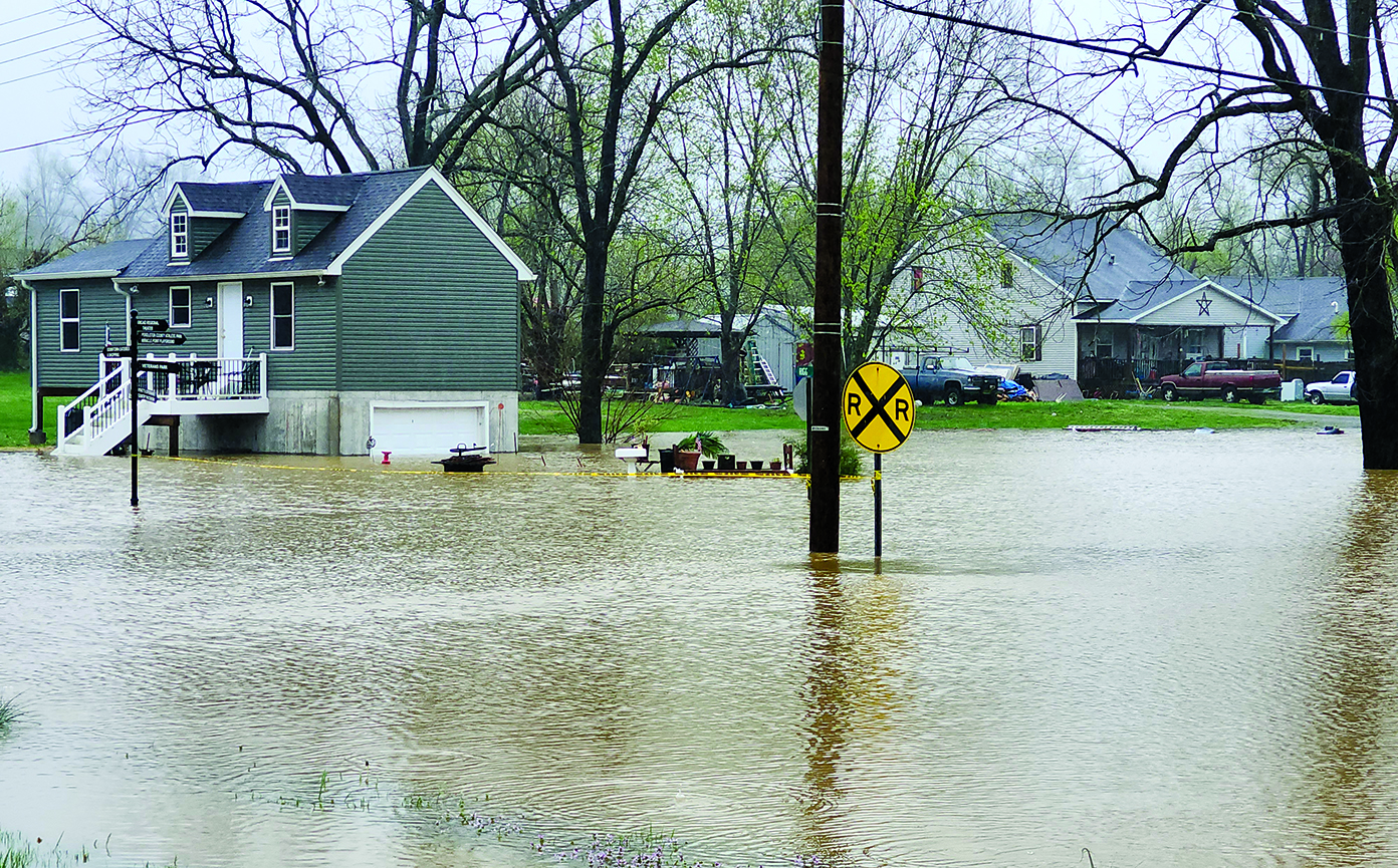
High waters caused “a minimal effect to housing, that I’m aware of,” Falmouth Mayor Luke Price said Sunday afternoon. “The majority affected was basement flooding.”
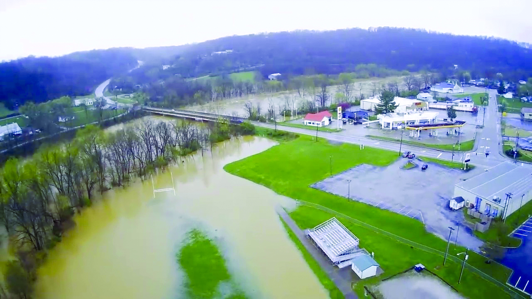
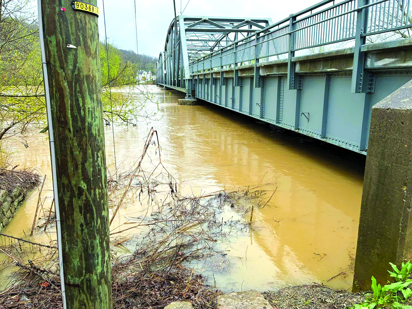
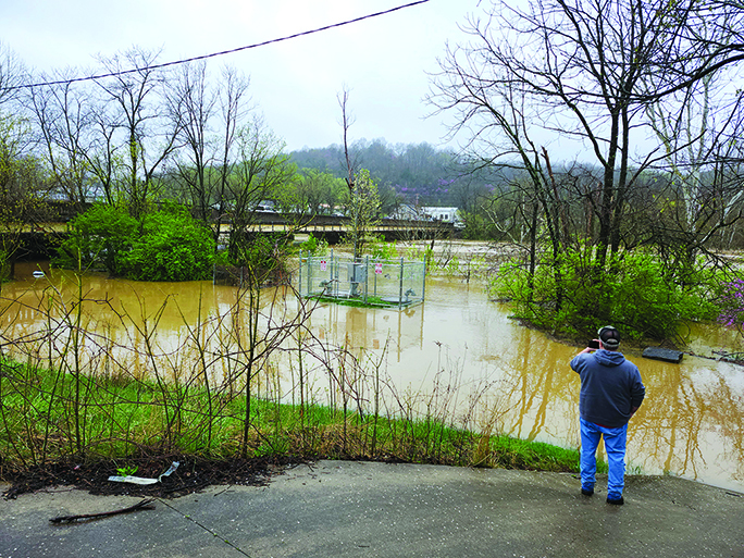
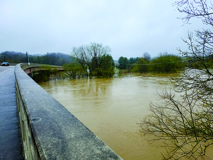
Flood stage for the Licking River is 33 feet. Friday night, the best projections based on rain forecasts had the river cresting at as much as 46 feet Sunday evening. On Saturday, the crest was projected at 42 feet.
But the predicted downpour fizzled to more of a mist, and the river crested at 38.63 feet at 7:15 p.m. Sunday — still enough to overflow roads and low-lying areas, but much less than the catastrophic levels of 1997 when the river crested at 51.8 feet.
“We got very, very lucky, very fortunate that the rain held off,” Price said.
While a couple of inches of rain was forecast for Sunday, less than an inch was recorded.
Year-to-date, Pendleton County averages 11.78 inches of rainfall through April 7, but this year recorded 18.78 inches so far.
The Kentucky Transportation Cabinet reported that as of Monday morning, state roads still closed for high water in Pendleton County included the KY 177 truss bridge over the Licking River between River Road and Mill Street; KY 177 between U.S. 27 and Duckers Woods Road; KY 177 between KY 467 to Pendleton/Kenton County Line; KY 177 at the railroad tunnel near Butler; KY 22 between KY 159 and Milford Road; KY 177 between U.S. 27 to KY 609 and KY 609 between Davis Road and Quail Run Road.
KY 330 from Tobacco Road to KY 1054 has been cleared.
Portions of various streets in Falmouth and Butler remain flooded. The city became a virtual isolated island on Sunday with both the bridge and tunnel accesses into Butler cut off by high waters.
WILD WEATHER
The wild week of weather began last Tuesday when Pendleton County Emergency Management issued the advisory: “Please be aware, we are facing a very active weather pattern this week.”
Strong south winds with gusts up to 50 mph began Wednesday morning, with severe storms and tornado warnings hitting Wednesday night.
By the wee hours of Thursday, gusts of up to 60 mph and penny-sized hail were reported. The winds broke multiple poles and downed power lines south of Falmouth in the Bishop Ridge area.
The city was without power for more than 20 hours on Thursday. Pockets of outages were reported throughout Northern Kentucky from the storms.
The heavy rains swelled rivers, and flood warnings were issued Friday. The Licking River was predicted to crest at 41 feet by late Sunday or early Monday. The projection river height increased as rains continued.
By Saturday, Butler shut down its sewer system. Mandatory evacuation orders were issued for both Butler — by 4 p.m. Saturday — and Falmouth — by 8 p.m. Saturday.
All day Saturday, residents could be seen helping each other load household goods, appliances and inventory out of their homes and businesses onto pickup trucks, trailers and U-Haul trucks.
“The mandatory evacuation went well. It was very well received with the community and citizens,” Price said.
Members of city council, city employees and volunteers went door to door Saturday to make sure residents knew of the evacuation order.
“Only 15 people were at the shelter last night,” Braun said Monday. “They had three shelters available and only had to open one. And the Red Cross was feeding everyone.”
While U.S. 27 remained open to through traffic, Falmouth posted emergency vehicles at every side street along U.S. 27 by 11:30 a.m. to block nonresident access into the city, and the Hwy 177 bridge over the Licking River going into Butler was shut down by 2 p.m. Sunday (the tunnel into the other side of town already was closed).
As the predicted downpour held off on Sunday and the river leveled out, the mayor called off the vehicle blocks at 5 p.m. Sunday.
THE AFTERMATH
Damage assessments and what comes next will be made this week as the waters recede.
Natural gas was shut off in areas predicted to flood in Falmouth, but electricity and water, for the most part, remained on.
“We were very, very fortunate that we didn’t have to shut off much utilities and infrastructure,” Price said. “We will be evaluating in the next few days what damages there are.”
Butler Mayor Mason Taylor deferred assessing the situation in his city Monday morning because “it’s still pretty busy.”
While residents were able to return to Butler at 4 p.m., the sewer system was still off. Residents were told to use portable toilets that had been set up at the Butler Baptist Church.
“Do not flush your toilet or let water go down any of your drains to prevent a potential backup,” the city posted. “More information will follow as this situation changes.”
One of the ongoing situations was a significant spill of motor oil and diesel fuel at a trucking garage caused by high water Sunday night near Northern Elementary School just outside of Butler.
“That’s being mitigated as we speak,” Taylor said Monday morning.
Price praise the efforts of first responders, volunteers and neighbors helping neighbors throughout the power outages and high waters.
“It was a valiant effort by the county, the city of Falmouth and the city of Butler,” Price said.
FLOOD OF 1997
On the night of March 1, 1997, heavy rains caused the Licking River to rise to 51.8 feet, well over flood stage, covering most of Falmouth.
That flood was the worst in the town’s history, breaking the previous record of 47.1 feet set on March 10, 1964.
Other historic crests were 41.6 feet on April 14, 1948, 41.4 feet on Jan. 23, 1937, and 40.8 feet on Jan. 1, 1922.